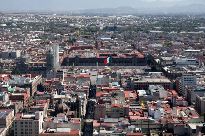
Mexico City, one of the largest urban centers on Earth, is slowly disappearing beneath its own weight. The massive metropolis is sinking so quickly that scientists can now observe the movement from space using advanced satellite technology. Recent radar imagery has revealed that some parts of the city are dropping by more than half an inch every month, making it one of the fastest-sinking capitals in the world.
The city’s sinking problem is closely tied to its history and geography. Long before modern buildings and highways covered the region, the area was part of a vast lake system. Today, the city still rests on soft, water-rich ground and an ancient underground aquifer that supplies drinking water to millions of residents. With a population exceeding 22 million people, demand for water has increased dramatically over the decades.
To meet this growing need, enormous amounts of groundwater have been extracted from beneath the city. As water is pumped out faster than nature can replace it, the underground layers begin to collapse and compact. This process causes the land above to sink, a phenomenon known as subsidence.
Scientists have warned for years that excessive groundwater extraction could trigger severe environmental and infrastructure problems. Now, satellite technology is offering a clearer picture of just how serious the situation has become.
Satellite Technology Reveals the Extent of the Crisis
New observations gathered by the NISAR satellite mission, a collaboration between the United States and India, have shown dramatic changes in the city’s elevation. The satellite uses powerful radar systems capable of detecting even the slightest movements on Earth’s surface. Between late 2025 and early 2026, researchers tracked sections of Mexico City that dropped nearly 0.8 inches per month. Over the course of a year, that would amount to more than nine inches of sinking ground.
Some of the hardest-hit areas include important transportation zones such as Benito Juarez International Airport. Uneven sinking creates major challenges for roads, railway systems, pipelines, and buildings. Cracks in streets, leaning structures, and damaged water lines have become increasingly common across the city.
The impact can even be seen in famous landmarks. The Angel of Independence monument, a well-known symbol of the nation built in 1910, has gradually sunk over time. To compensate for the changing ground level, additional steps had to be added to the base of the monument.
Urban growth has made the crisis even worse. As the population expanded, more buildings, highways, and infrastructure projects added pressure to the already fragile clay-heavy soil beneath the city. Combined with continued groundwater extraction, the result has been decades of steady land collapse.
Experts also fear that the sinking problem is linked to a worsening water shortage crisis. Ironically, while the city pumps enormous amounts of water from underground, many neighborhoods still face unreliable access to clean water. Officials have warned about the possibility of a “day zero” scenario in which reservoirs and water supplies become critically low.
Researchers say the satellite mission is only beginning to uncover the full scale of global land subsidence. Beyond tracking sinking cities, the technology can also monitor glaciers, crop growth, earthquakes, volcanic activity, and other environmental changes.
For Mexico City, however, the findings are a stark reminder that environmental strain and rapid urbanization are reshaping the ground beneath millions of people. Without long-term solutions to water management and infrastructure planning, the city’s slow descent may continue for generations.